Description
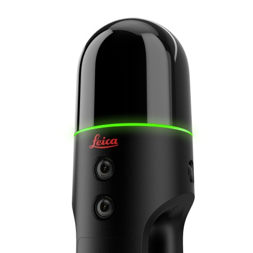
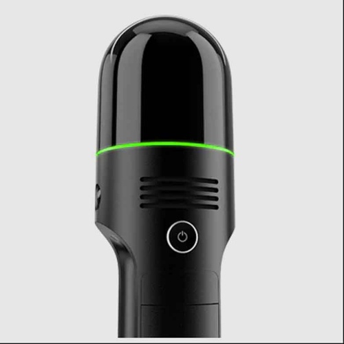
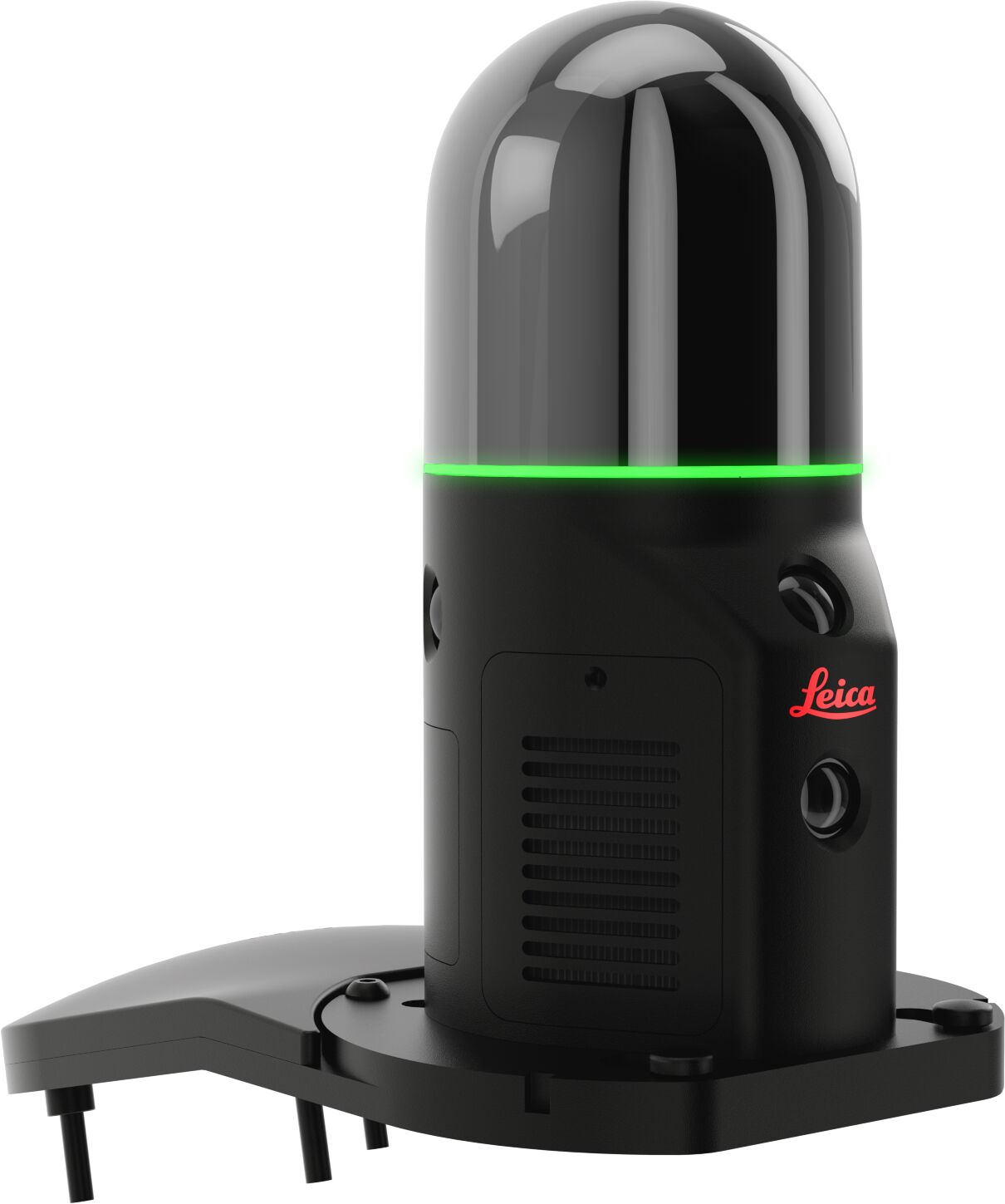
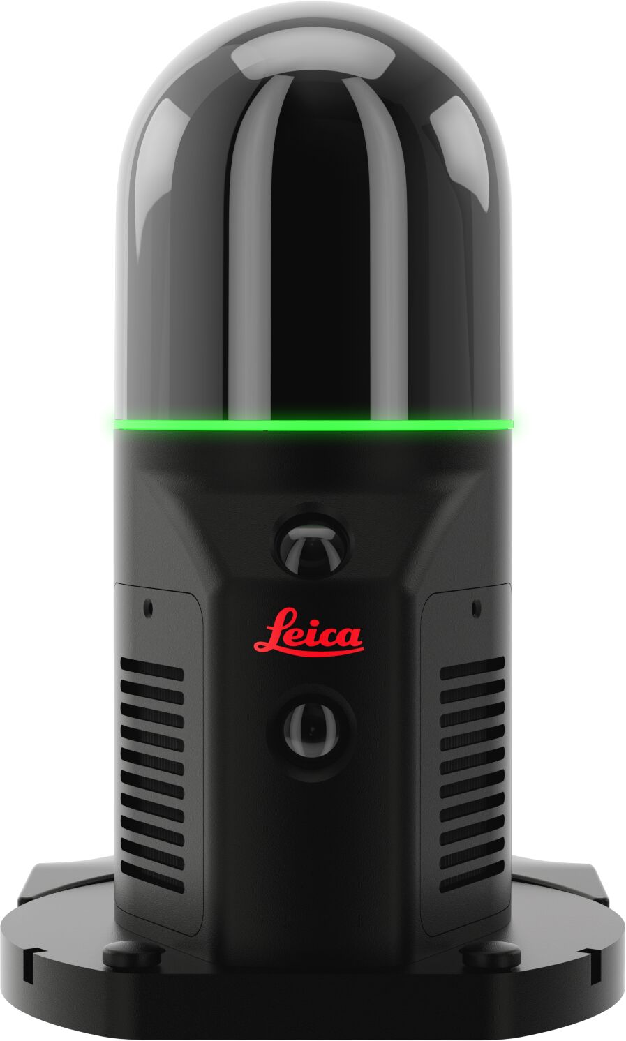
The Leica BLK ARC is an autonomous laser scanning module designed to be integrated with robotic platforms, enabling fully autonomous mobile reality capture in environments that are hazardous, repetitive, or difficult for personnel to access. By combining advanced LiDAR technology with Leica Geosystems’ GrandSLAM positioning and navigation capabilities, the BLK ARC allows robots to independently navigate, scan, and generate accurate 3D point clouds with minimal human intervention.
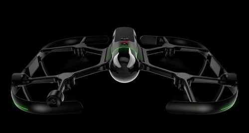
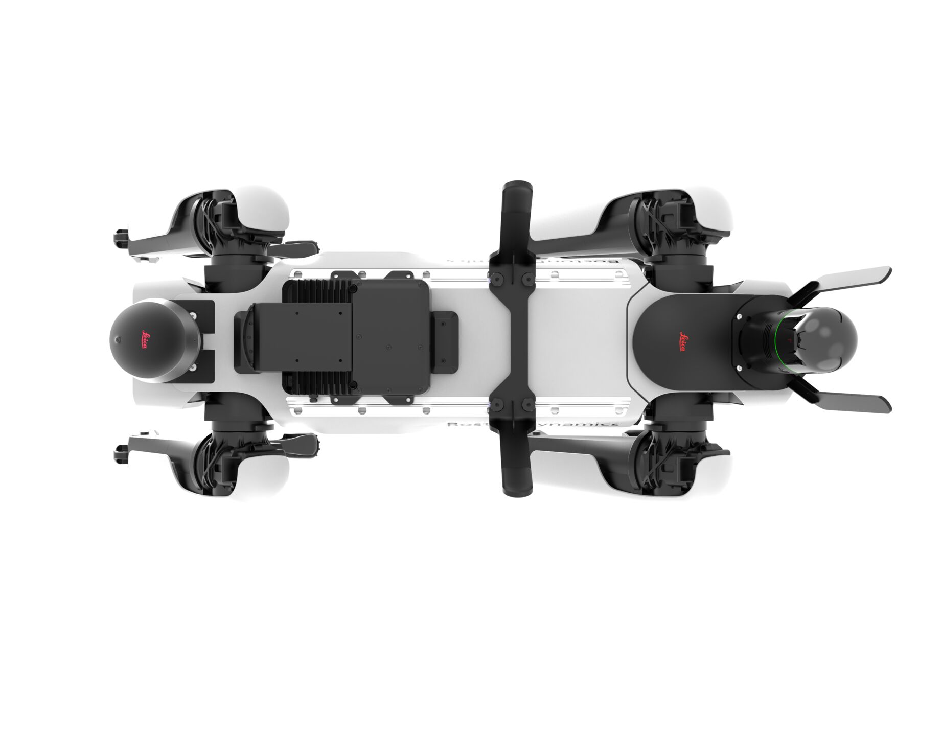
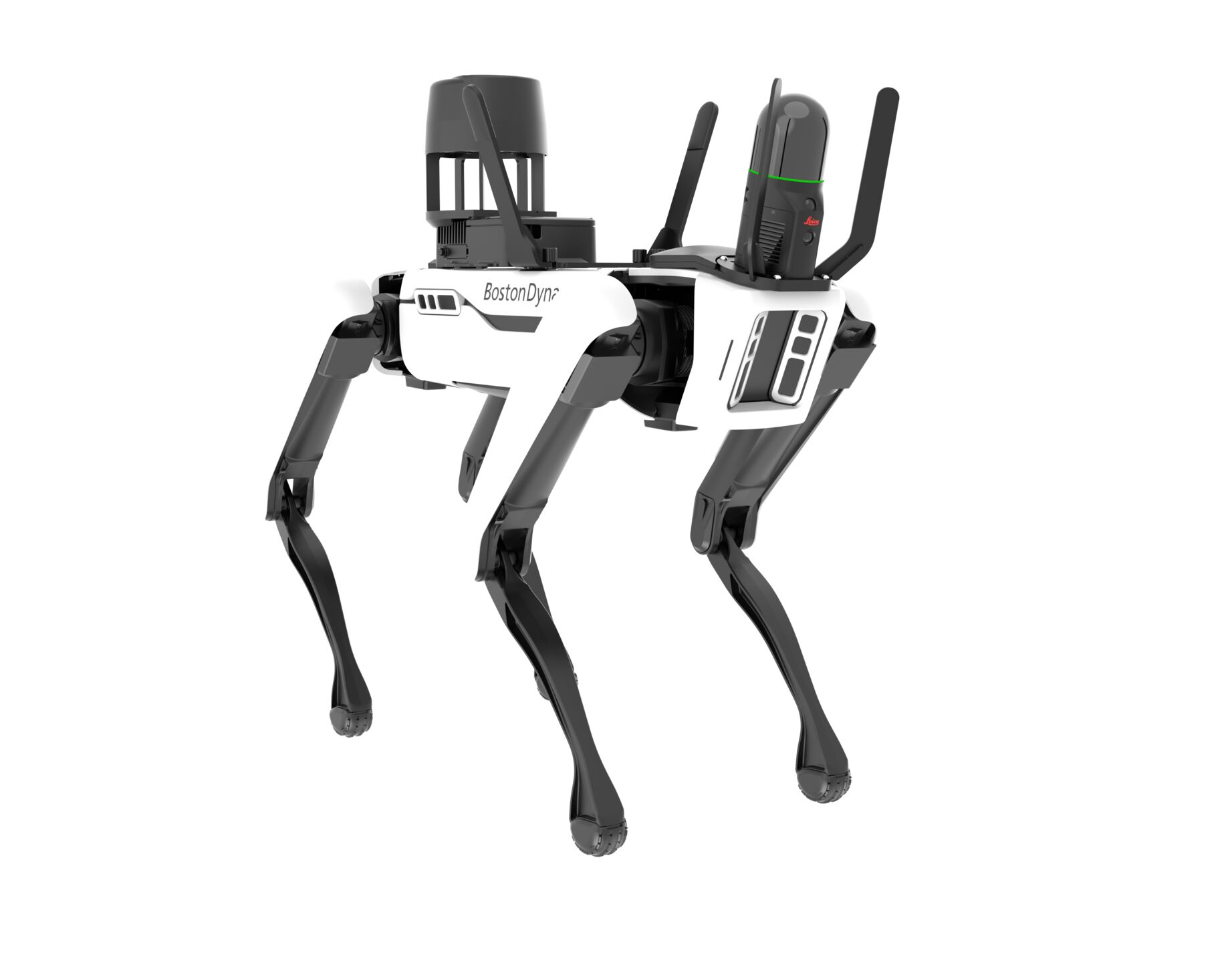
Designed for integration with robotic carriers such as mobile ground robots, the BLK ARC can perform both mobile and stationary scans during a single mission, creating comprehensive digital representations of buildings, industrial facilities, construction sites, infrastructure, tunnels, mines, and other complex environments. Users can plan scan missions remotely and deploy the system to repeatedly capture site conditions, monitor progress, and document changing environments safely and efficiently.
The BLK ARC is particularly valuable for applications requiring frequent data collection or operation in areas where human access is limited or unsafe. Its autonomous workflow improves efficiency, enhances worker safety, and provides consistent, high-quality reality capture data for digital twins, inspections, facility management, asset monitoring, and construction documentation.
Key Features:
- Fully autonomous mobile laser scanning
- Designed for integration with robotic platforms and autonomous carriers
- Leica GrandSLAM technology for simultaneous localization, mapping, and navigation
- Captures high-density 3D point clouds and panoramic imagery
- Performs both mobile and static scans within a single mission
- Remote mission planning and deployment
- Ideal for hazardous, inaccessible, or repetitive scanning environments
- Supports digital twin creation, facility documentation, inspection, monitoring, and asset management workflows
- 360° horizontal and 270° vertical field of view with up to 420,000 points per second capture rate
Typical Applications:
- Construction progress monitoring
- Industrial facility documentation
- Infrastructure inspection
- Mining and underground environments
- Public safety and emergency response
- Facility management and asset monitoring
- Historic preservation and site documentation
- Autonomous reality capture and digital twin development